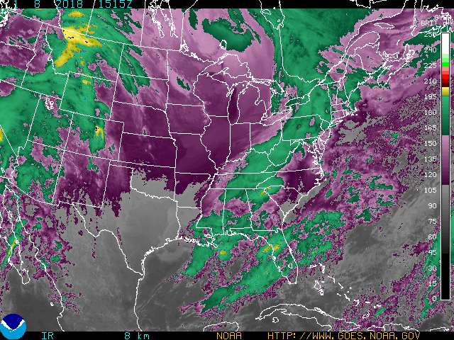
Meteorologists use color enhanced imagery as an aid in satellite interpretation. The colors enable them to easily and quickly see features which are of special interest. Usually they look for high clouds or areas with a large amount of water vapor.
» Enhancement types
In an infrared (IR) image cold clouds are high clouds, so the colors typically highlight the colder regions. The bar on the right side of the image indicates the pixel brightness values for the corresponding color. The intensity value represents emitted infrared radiation. The intensity of a pixel is recorded as a digital number (for example, in these images the numbers range from 0 to 255.) You can determine temperatures using one of the formulas below:
If B > 176, T = 418 - B; or
if B <= 176, T = 330 - (B/2)
Note that the resulting temperatures are in Kelvin.
To calculate the resulting Kelvin temperature to Fahrenheit: (K - 273.15) x 1.8 + 32.00.
To calculate the resulting Kelvin temperature to Celsius:
C = K - 273.
(B = Brightness value; T = Temperature; F = Fahrenheit; C = Celsius)
Note: Imagery and loops on this site are intended for informational purposes only, they are not considered "operational". This web site should not be used to support operational observation, forecasting, emergency, or disaster mitigation operations, either public or private. In addition, we do not provide weather forecasts on this site — that is the mission of the National Weather Service. Please contact them for any forecast questions or issues.